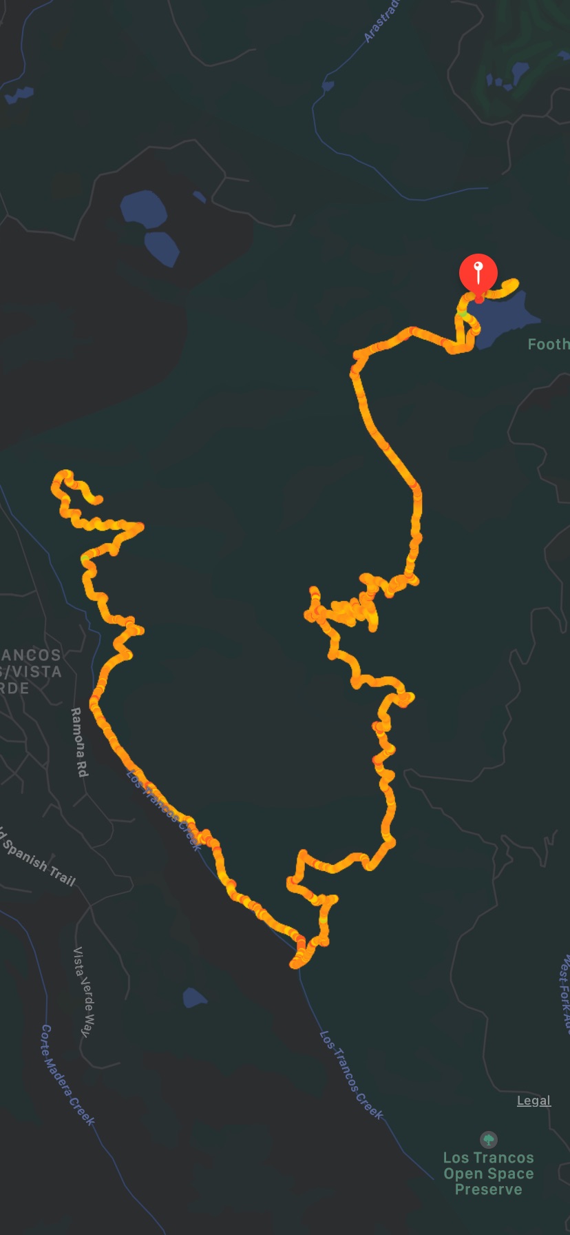
Palo Alto - Foothills Park - Los Trancos Trail
New Year...New Beginnings...New Adventures. Aren't we all ready to forget all about 2020 and start 2021 anew? I hope the new year brings health and happiness to everyone.
We decided to start the New Year with a positive outlook and the desire to do everything right - eat right, exercise, mindfulness. What better way than to hike to the mountains and enjoy some beautiful weather.
We had heard of a new Palo Alto Foothills park being recently opened to the general public. This park was only open to Palo Alto residents for the last 50 years but thanks to activists it was now available for everyone to enjoy. The weather was a bit chilly on 1/1 and rains were expected to start on 1/2 so the inner voice was strong to say let's go and enjoy the day... Park Map

We planned to start the hike around 10 am to get the most benefit of the day. Maps show you two locations - Palo Alto and Los Altos when you enter the address. We picked the Palo Alto location as a few of us had planned to meet at the Interpretive Center and hike the Los Trancos Trail. As we entered through the checkpoint we saw that parking was spread out in the park so drove a bit further and parked near Vista Point. It took us about 15-20 minutes to walk back to the Interpretive Center. Phone signals are a bit weak in the park so it can get tricky if you are trying to coordinate and find everyone. We ultimately met our group near the lake. The lake is really pretty with birds and ducks and many young families were spending time there.


As we entered the trail, the path quickly changed from the flat picnic area to a windy path lined with redwood trees all around. The trail is rugged so definitely recommend hiking shoes. After about 2 miles we took a break for some quick snacks - mini tea sandwiches, oranges, and gummies. The trail does have an elevation of about 1700 ft so often reminded of Mission Peak in Fremont.
The next mission for us was to find the waterfall you see when you look up pictures of the park online. After about a mile we did find water flowing through the rocks but I wouldn't call it a waterfall yet 😏. The sound of water was really soothing with a little bench on the side, so we took a quick break to enjoy the sounds and catch our breath.

We continued upward and after about another mile we started seeing the Palo Alto mansions. We stopped by to take pictures with the mansions as the backdrop but continued walking. Another half a mile and we reached the top of the mountain which made us feel like we were on top of the world. The view was breathtaking with downtown San Francisco and the Bay Bridge in the background. On each side, you could see a part of the Bay. Closer to us were the San Mateo Bridge and the Dumbarton bridge. We took a long break there and the kids got a chance to relax while we took a lot of pictures. There is a bench as well to sit down and enjoy the views.
This is the max elevation point of the trail. After about a half-hour break we started the downward trek to get back to the base. The trail had signs at regular intervals to make sure you are on the right path. Be careful at the turns while getting down as there's a bigger risk of falling. After about 2 miles we got to the bottom and onto flat ground. From now on the trail was paved and a much easier walk. We reached the picnic spot in another 1/2 mile and then in another 1/2 mile which seemed the never-ending part of the trail we reached the lake. It was getting close to sunset so the lake was a perfect spot to linger around. The birds were starting to wrap up their day and perching on the tree near the lake. The ducks seemed unfazed by the end of the day and continued their routine ☺
Wow - What a beautiful hike I started thinking as I caught my breath. We truly enjoyed it and were ready to head back home happy and tired. A total of 9 miles and a pace of about 2 miles per hour. We ended up spending the entire day walking, talking, and enjoying the views all around.
A little surprise all along the trail was the variety of mushrooms we saw along the trail. I am no mushroom expert and don't even know if any of these mushrooms are edible or poisonous but it definitely motivated all of us to go on a foraging trip.

Food/ Snacks we took:
1. Snacks - Z-bars, Protein Bars, Chips, Gummies, Mini cookies
2. Fruits - Cuties Oranges
Picture credits: V, Food credits - MAP
Shef: https://shef.com/order/shef/alpa-p
Metrics:
Hike Count: 1
Miles Hiked: 9


Comments
Post a Comment